


According to recent research, climate warming is worsening future flooding emergencies at both high and low elevations. Approximately 15 million people worldwide live under the shadow of glacial lakes, with more than half of them in India, Pakistan, Peru, and China.
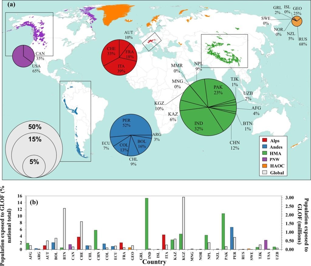
A second research documented over 150 such floods and climate change, which was mostly driven by the mining and burning of fossil fuels, increasing glacier melt and making lakes larger and more deadly. We had glacier lake outburst floods in the past that have killed many many thousands of people in a single catastrophic flooding event. Due to climate change glaciers are melting so these lakes are getting bigger, potentially getting more unstable.

A related research published in Earth’s Future predicts that rising sea levels would sink more than twice as much land as earlier models predicted. The latest projections indicate that sea-level rise (SLR) is certain to exceed 2 m in coming centuries, and a rise by 4 m is considered possible.
Radar-based land elevation models applied to date suggest that the increase of area below mean sea level, that is potentially exposed to permanent flooding, will accelerate as SLR proceeds, being relatively limited initially. However, applying new and more accurate satellite LiDAR elevation data we find the opposite pattern, with the fastest increase in the area of exposed land occurring in the early stages of SLR.
In one-third of countries most of this increase will be caused by the first meter of SLR and in nearly all within the first 2 m. We conclude that in many regions the time available to prepare for increased exposure to flooding may be considerably less than assumed to date.
Reference- The Hindu, The Indian Express, Nature Communication, Earth’s Future, National Geographic